
Location > Nepal > Annapurna
Overview
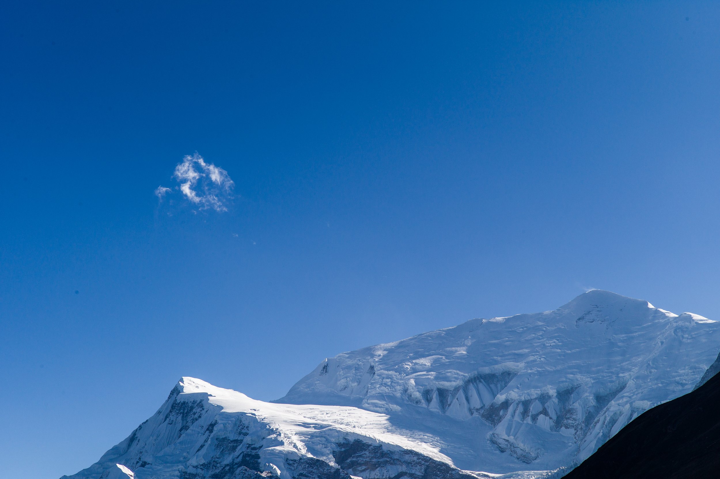
The Annapurna Circuit has it all - grand, sweeping mountain vistas, freshly baked croissants and morning coffee in cosy village cafes, and of course, the crossing of the iconic 5416m (17769ft) high Thorong La pass towards the end of a more than week-long trek.
In decades past, the busy long-distance bus station in Besishahar had marked the start of the circuit. Its equivalent to the west in the town of Beni south of Tatopani had been the welcome conclusion of the long, long circuit.
But with the construction of roads, both ends of the original circuit have been effectively curtailed.
Purists would persist in following the old route, walking on busy dirt roads.
Most other hikers would drive to the large village of Chame, now the beginning of the new circuit.
On the other side of the Thorong La pass, Muktinath is the unofficial terminus.
Despite the abbreviated circuit, the circuit still retains much of its original draws - proximity to some of the world’s highest peaks, world-class trekking routes, and it is still a gateway to other treks in nearby regions such as Mustang and the “lost” valleys of Nar and Phu.
Hikers can also join up with the lower Annapurna trails to the south leading to the Annapurna Sanctuary, an amphitheatre of towering peaks of ice and snow.
Day 1: Arrive in Nepal’s bustling capital of Kathmandu
The vast majority of visitors from around the world fly into Kathmandu, a sprawling city of more than 1.6 million people. As you step out of Tribhuvan International Airport, you will be greeted by your guide or a company representative who will drive you to your hotel. After finalising your itinerary with your guide at the hotel and answering any remaining questions you might have, you are free to go explore the warrens of colourful alleyways and tourist attractions in downtown Kathmandu. Restaurants, bars and shops open till late during peak tourist seasons.
Day 2: Kathmandu to Chame (2670m)
Charge up with an early breakfast at your Kathmandu hotel. The day’s adventures beckon as you and your guide load up the jeep. It will be a scenic drive today through classic Nepal landscapes of lush sub-tropical valleys, terraced fields and winding mountain roads as you head west towards the Annapurnas. You will likely arrive in Chame (2670m/8760ft), the administrative centre of Manang district, in time for dinner over a traditional wood burning stove at a cosy homestay or at a locally run teahouse. If the stars are aligned, step out and look east as the setting sun lit up the snowy summits of the Manaslu range.
Day 3: Chame to Upper Pisang (3300m)
Say goodbye to Chame and leave your jeep behind as you walk west and enter the broad Manang valley, which you will cover in its entirety over the course of the coming days. Hike through pine forests and traditional villages alongside the Marsyangdi River as you admire the first peaks of the Annapurna range. The valley narrows dramatically at one point as you follow a trail etched into cliffs of stone. Stop at Dhukure Pokhari (3185m/10450ft) for lunch at one of the many open roof-top restaurants run by teahouses along the trail. At this elevation, you might feel slightly fatigued despite having walked for just a few hours. After a satisfying meal of dal bhat (Nepal’s national dish!), momos (dumplings) or Tibetan thukpa noodle soup, you continue west as the valley widens again. On a magnificent day, the sky above is a dome of the bluest blue. In the late afternoon, you arrive at Upper Pisang (3300m/10827ft), a large village on the southern flanks of the 6091m high Pisang Peak. Across the valley lies Annapurna II (7937m/26040ft), the second-highest peak in the Annapurna range, and slightly further west, Annapurna III (7555m/24787 ft). After dinner, chat with new-found friends, read, or retire early if fatigue sets in.
Day 4: Upper Pisang to Manang (3540m)
Wake up to stunning views of Annapurna II and Annapurna III to the south (or wake up before first light to catch the sunrise from the Tibetan monastery at the top of the village). After breakfast and as you get ready to go, you have two options – take the lower trail if you still feel the effects of the altitude from the day before, or take the exciting higher trail where views get more spectacular as you ascend. We recommend the higher trail, which helps with your ongoing acclimatisation. Just start your day early. Go slowly as the trail rises with the contours of the hillside. Before long, you arrive at Ghyaru (3670m/12040ft), a medieval-looking village of stone houses perched on the side of cliffs. Like many rural areas in Nepal, few men are seen in Ghyaru, most of whom are working in Kathmandu or abroad. The elderly stay behind to look after young children for a few years, before they are old enough to chase higher wages in big cities or in a foreign land. As the trail rises further, the distinctive roof-like summit of the 7455m Gangapurna emerges along the Annapurna chain, with Tibetan prayer flags fluttering in the wind and providing the perfect foreground for your photograph. Stop for lunch and coffee at Ngawal (3650m/11975ft), a large village overlooking the valley. It is also known as Nawal. The trail continues with more National Geographic views and soon descends to the valley floor. From the village of Braka, Manang (3540m/11614ft) is just 30 minutes away. This will likely be a long day for you. As much as the bakeries and coffee shops in Manang might entice you, it is probably a good idea to turn in early and leave your exploration for the next day!
Day 5: Rest Day in Manang (3540m)
You will stay in Manang for one more night and use the day as an acclimatisation day. To help acclimatise, explore the village, stock up on souvenirs like local handicrafts, or take it easy. The Turquoise Lake below Gangapurna is also a leisurely way to spend the morning. You can also visit the Himalayan Rescue Association, which has a daily talk in the afternoon on how to handle the altitude. If you are feeling good, consider backtracking to Braka to visit a stunning Tibetan monastery on the craggy slopes of a hill. Some visitors venture further up Braka to the so-called Ice Lake (4600m/15091ft) as an acclimatisation exercise and also for the sensational views that it offers. You wouldn’t need to reach the lake for the best views. Any walk today to a higher elevation (not necessarily 4600m) would help you acclimatise.
Day 6: Manang to Yak Kharka (4018m)
The next stage of your journey begins with your departure from Manang. As the trail takes you above the tree line, the surrounding peaks start to lean in, seemingly, as the landscape grows a touch more austere and the sky a tinge bluer with each and every step you take. When you reach Yak Kharka (4018m) at the end of today’s short trek, you will be sleeping at an altitude of more than 4000m. The vast majority of hikers have no issues at Yak Kharka (literally “a pasture land for yaks”), a cluster of colourful and welcome teahouses. Those who are having serious doubts about walking further but would still like to cross the epic 5614m-high Thorong La pass at the end of the Manang valley can consider riding to the top on a pony! It is financially more prudent to hire a pony while in Manang, as prices rise with the altitude the closer you get to Thorong La pass. Turn in early, as the sun disappears behind the towering peaks quite early in the afternoon, turning Yak Kharka into a cold, cold place.
Day 7: Yak Kharka to Thorong Phedi (4450m)
Today is another short day, and you will not complain, as the altitude starts to take its toll on your pace. Thorong Phedi (4450m/14600ft), which means “at the foot of Thorong”, marks the head of the Manang valley and your base ahead of your steep walk up to the Thorong La pass the next morning. Over the decades, the Thorong La pass has attained somewhat of a mythic status on the Annapurna trekking circuit, being literally the high point of a trek that attracts more than 10,000 hikers each year. At 5416m (17769ft), Thorong La is also one of the highest non-technical passes in Nepal accessible to the average hiker. Some hikers, arriving at Thorong Phedi at midday, decide to climb further to High Camp (4880m/16010ft) for the night. We do not recommend this course of action. The big gain in altitude from Yak Kharka to High Camp of more than 800m sharply increases the chances of Acute Mountain Sickness, which would derail all the progress you have made thus far. Almost all who sleep at High Camp have no sleep at all, tossing and turning through the night as they wrestle with symptoms of AMS. For safety reasons, we sleep at Thorong Phedi.
Day 8: Thorong Phedi to Thorong La Pass (5416m) to Muktinath (3800m)
Rise early for the hike up to Thorong La. The majority of hikers have an early breakfast at 3:30 a.m. and start hiking at 4:00 a.m. Some reach the pass at 8:00 a.m., some at 11:00 a.m. Either is not dictated by you, but by how your body adjusts to the higher elevations. And it is OK either way, because a trek is not a race. There is no shame for being slow, or even being the last trekker to arrive!
Two other factors to keep in mind: weather and visibility at the top and recent snow conditions. If the weather unexpectedly gets bad while you are at Thorong Phedi, it would be more prudent to wait it out than to risk getting trapped in a white-out at higher elevations under sub-freezing temperatures. Hikers have died at the pass due to adverse weather conditions. Separately, if it had snowed recently, chances are the trails at higher altitudes would have turned icy. Ice spikes which you can strap on to your boots are cheap and easy to come by in Kathmandu. Pack a pair as insurance. Full-fledged mountaineering crampons are not necessary.
Finally, you are at the pass at long last. Celebrate reaching the highest point of your trek surrounded by stunning panoramic vistas. As you start to commence your descent on the other side of the pass, the brown cliffs and peaks of Mustang stare back at you as you enter a dry region historically protected from the Indian Monsoon by 7000-8000m peaks. The descent of 1600m from Thorong La to Muktinath (3800m/12467ft) takes at least two hours and you will arrive just in time for lunch.
If you feel sufficiently revived, do consider visiting the Muktinath temple, sacred to Hindus and Buddhists alike. Each year, hundreds of thousands of pilgrims across India and Nepal visit the temple, dedicated to the Hindu god Vishnu. Many bathe in a pool, believing that its waters would wash away their sins – a fitting end to your multi-day trek!
Day 9: Muktinath to Pokhara (822m)
We bid farewell to Muktinath and its pilgrims as we start our drive back to “civilisation” and modernity. You will arrive at the city of Pokhara in the early afternoon, but not before you pass through one of the world’s deepest gorges. Separating the towering Annapurna and Dhaulagiri ranges is the Kali Gandaki river, which flows from Upper Mustang, through the Himalayas and later into the Gangetic plain. A narrow unpaved road hugs close to the western Dhaulagiri side of the gorge, the only motorable route that links the region of Mustang with the rest of Nepal. A few hardy travellers fly out of the region from the dusty town of Jomsom in Lower Mustang to Pokhara. But most find it too unnerving to brave the strong Himalayan winds on a tiny propeller aircraft, despite the short 25-minute flight. In Pokhara, by the placid surface of Phewa Lake, all the cares of yesterday would seem like a world away. Treat yourself to a well-deserved hot shower and relax in one of the many cafes in the quiet lakeside city.
Day 10: Pokhara to Kathmandu
Enjoy a picturesque morning in Pokhara as you gaze as the reflection of the Annapurna mountains on the surface of Phewa Lake. Take your time to revisit favourite spots (that particular French creperie that must be kept a secret?) before taking the jeep back to Kathmandu. Again, we prefer to travel by road than fly, given frequent flight delays and chaos at the Pokhara airport. With a jeep, leave as and when you like, and stop when and where you wish.
Day 11: Goodbye – for now
Bid farewell to your guide or even travel mates as you are being driven to the airport for your departure from Nepal. We look forward to your return some day!
START/END Kathmandu
LODGINGS Hotel/ teahouse
MEALS All inclusive
TRANSPORTATION Private vehicle
BEST SEASON Mid-March to May and late September to early December
TRIP DURATION 11 days
TREK GRADING Moderate to Strenuous
TOP ELEVATION 5416m/17769ft
How Big is Your Trekking Party?
Just myself……….$2,045
Two people……….$1,316 each
Three people……$1,213 each
Four people………$1,061 each
For larger groups, just ask us!
TRIP INCLUDES
Pick up from airport on day of arrival
Hotel stay in Kathmandu for 2 nights and in Pokhara for 1 night
Private vehicle from Kathmandu to trek start point and back
All meals (breakfast/lunch/dinner) en route and during trek, and 3 hot beverages each day of your choice
Stay at teahouses or homestays during trek
English-speaking and government-trained guide
Porters to carry your luggage (ratio of 1 porter to 2 guests)
All necessary paperwork, trekking permits and local taxes
TRIP EXCLUDES
Meals in Kathmandu (except breakfast at hotel)
Visa fees and cost of international travel to and from Kathmandu
Personal expenses
Travel insurance, including coverage for outdoor activities up to 5,500 metres, search-and-rescue in mountainous areas, and costs of helicopter evacuation
Tips for guide, porter(s) and driver(s)